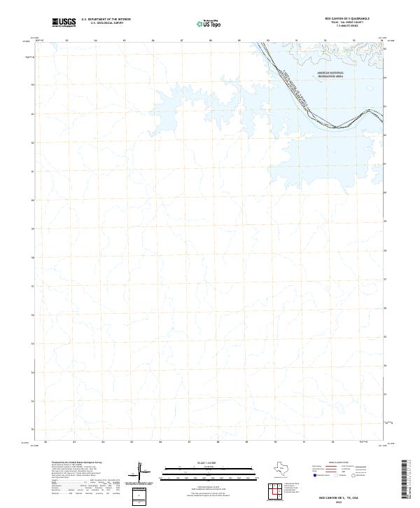
2022 Map of Box Canyon OE S
USGS Topo · Published 2022About this map
The Rio Grande carves a winding path along the international border in this 2022 survey of Val Verde County. This specific section of the river is part of the Amistad National Recreation Area, where the landscape is defined by the backwater canyons and inlets formed by the damming of the river downstream. The boundary between the United States of America and Estados Unidos Mexicanos is clearly delineated as it follows the deep center of the river channel.
Find a feature on this map
3 named features on this map. Tap any name to fly to it.
Don’t see what you’re looking for? This feature index may not catch every label — zoom into the map to look around manually.
Map Details
Editions of this 2022 Box Canyon OE S Map
This is the sole edition of this map. No revisions or reprints were ever made.
Other maps of this area

1941 · Feely
USGS Topo · 1:62,500

1943 · Devils River
USGS Topo · 1:62,500

1944 · Devils River
USGS Topo · 1:62,500

1944 · Mouth Of Pecos
USGS Topo · 1:62,500

1958 · Del Rio
USGS Topo · 1:250,000

1964 · Del Rio
USGS Topo · 1:250,000

1972 · Amistad Dam
USGS Topo · 1:24,000

1972 · California Creek
USGS Topo · 1:24,000
1972 · Zuberbueler Bend
USGS Topo · 1:24,000
1972 · Box Canyon
USGS Topo · 1:24,000