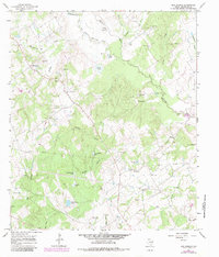
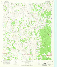
1966 Map of Box Church
USGS Topo · Published 1983About this map
Box Church and Old Union anchor this mid-century portrait of rural Limestone County, where the Navasota River and its Old Channel wind through a landscape defined by small-scale agriculture and early energy development. The geography is notably dotted with family and community burial grounds, including the Hughes and Hyden Cem, Potter Shop Cem, and Lenamon Cem, offering significant value for genealogists tracing local lineage. The terrain rises to Andrews Hill and Cedar Mound, overlooking a complex network of creeks such as Faulkenberry Creek and Montgomery Creek. While small settlements like Blains and Old Union Ch mark the crossroads of community life, the map also documents the industrial presence of numerous Gas Wells and a major Pipeline cutting across the southern portion of the quadrangle.
Find a feature on this map
43 named features on this map. Tap any name to fly to it.
Don’t see what you’re looking for? This feature index may not catch every label — zoom into the map to look around manually.
Map Details
Editions of this 1966 Box Church Map
2 editions found
Other maps of this area

1920 · Mexia
USGS Topo · 1:62,500

1954 · Waco
USGS Topo · 1:250,000

1955 · Waco
USGS Topo · 1:250,000

1957 · Groesbeck
USGS Topo · 1:62,500

1960 · Groesbeck
USGS Topo · 1:24,000
1966 · Round Prairie
USGS Topo · 1:24,000

1966 · Thornton
USGS Topo · 1:24,000
1966 · Teague South
USGS Topo · 1:24,000
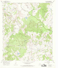
1966 · Box Church
USGS Topo · 1:24,000
1966 · Fallon
USGS Topo · 1:24,000