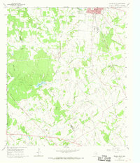
1966 Map of Teague South
USGS Topo · Published 1968About this map
The boundary between Limestone and Freestone counties bisects this mid-century landscape, where the southern outskirts of Teague give way to a network of creeks and small agrarian settlements. In the southwest, Personville sits at the junction of several county roads, while the smaller community of Asia is located further north along Patton Creek. The rail infrastructure of the Chicago Rock Island and Pacific and the Fort Worth and Denver railroads dominates the eastern half of the sheet, tracing the path of local industry and transport. Rural life is anchored by country churches like Cedar Creek Ch and Union Ch, while the terrain is marked by numerous water bodies including Browns Lake and the Sellers Lake reservoir. Local extraction is evident through scattered Gas Well sites and a Claypit, showing the transition from traditional farming to energy and mineral resource development.
Find a feature on this map
42 named features on this map. Tap any name to fly to it.
Don’t see what you’re looking for? This feature index may not catch every label — zoom into the map to look around manually.
Map Details
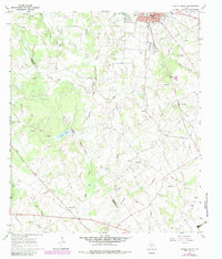
Editions of this 1966 Teague South Map
2 editions found
Other maps of this area

1919 · Fairfield
USGS Topo · 1:62,500

1920 · Mexia
USGS Topo · 1:62,500

1954 · Waco
USGS Topo · 1:250,000

1955 · Waco
USGS Topo · 1:250,000

1956 · Jewett
USGS Topo · 1:62,500

1963 · Teague North
USGS Topo · 1:24,000

1963 · Mexia
USGS Topo · 1:24,000

1965 · Dew
USGS Topo · 1:24,000
1965 · Fairfield
USGS Topo · 1:24,000
1965 · Donie
USGS Topo · 1:24,000