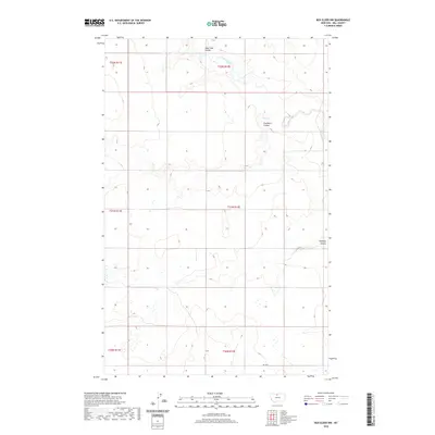
2020 Map of Box Elder NW
USGS Topo · Published 2020About this map
Sage Creek meanders through the heart of this North Central Montana landscape, carving a distinct path through the dry high plains of Hill County. The drainage network is characterized by several prominent depressions and runoff channels, including Sage Lake Coulee, Faulkners Coulee, and Halfway Coulee. These features represent the primary topographic variations in an otherwise expansive and open territory, primarily organized by the Public Land Survey System grids such as t31n r12e. While the area is largely characterized by its natural terrain, the presence of RD 120 S indicates the light infrastructure supporting the agricultural and ranching operations of this region. The map provides a detailed view of the water distribution and drainage patterns essential for land management in this part of the state.
Find a feature on this map
12 named features on this map. Tap any name to fly to it.
Don’t see what you’re looking for? This feature index may not catch every label — zoom into the map to look around manually.
Map Details
Editions of this 2020 Box Elder NW Map
This is the sole edition of this map. No revisions or reprints were ever made.
Other maps of this area

1904 · Boxelder
USGS Topo · 1:62,500

1906 · Kremlin
USGS Topo · 1:62,500

1906 · Boxelder
USGS Topo · 1:62,500

1919 · Big Sandy
USGS Topo · 1:125,000

1920 · Gildford
USGS Topo · 1:125,000

1943 · Gildford
USGS Topo · 1:125,000

1954 · Shelby
USGS Topo · 1:250,000

1958 · Shelby
USGS Topo · 1:250,000
1969 · Sage Lake
USGS Topo · 1:24,000

1969 · Box Elder NW
USGS Topo · 1:24,000