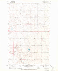
1969 Map of Sage Lake
USGS Topo · Published 1972About this map
Burlington Northern rails cut a sharp line across this northern Montana landscape, marking the primary industrial corridor through Hill County during the late 1960s. The terrain is defined by the ephemeral hydrology of the high plains, where the Alkali Lakes and Sage Lake occupy shallow depressions in the northern and central sections. A small Landing Strip and various Storage Bins scattered across the quadrangle suggest a sparsely populated area focused on dryland agriculture and localized transport.
Find a feature on this map
12 named features on this map. Tap any name to fly to it.
Don’t see what you’re looking for? This feature index may not catch every label — zoom into the map to look around manually.
Map Details
Editions of this 1969 Sage Lake Map
This is the sole edition of this map. No revisions or reprints were ever made.
Other maps of this area

1904 · Boxelder
USGS Topo · 1:62,500

1906 · Kremlin
USGS Topo · 1:62,500

1906 · Boxelder
USGS Topo · 1:62,500

1919 · Big Sandy
USGS Topo · 1:125,000

1920 · Gildford
USGS Topo · 1:125,000

1943 · Gildford
USGS Topo · 1:125,000

1954 · Shelby
USGS Topo · 1:250,000

1958 · Shelby
USGS Topo · 1:250,000

1969 · Box Elder NW
USGS Topo · 1:24,000

1969 · Gildford NE
USGS Topo · 1:24,000