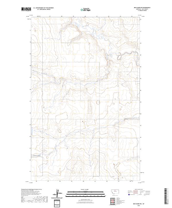
2024 Map of Box Elder NW
USGS Topo · Published 2024About this map
Sage Creek meanders through this section of the northern Montana plains, carving a distinct drainage pattern across the high prairie. The landscape is defined by its coulees, with Faulkners Coulee in the northwest and Halfway Coulee in the southwest serving as prominent topographical landmarks. This map details the Public Land Survey System grid across Hill County, showing the intersection of several townships including t31n r12e and t32n r11e. The sparsely populated terrain is navigated by a limited road network, most notably Rd 120 S in the southeastern corner. The contour lines reveal the subtle but significant elevation changes characteristic of this region's watershed, where drainage features like these coulees are essential for understanding historical land use and early ranching boundaries.
Find a feature on this map
10 named features on this map. Tap any name to fly to it.
Don’t see what you’re looking for? This feature index may not catch every label — zoom into the map to look around manually.
Map Details
Editions of this 2024 Box Elder NW Map
This is the sole edition of this map. No revisions or reprints were ever made.
Other maps of this area

1904 · Boxelder
USGS Topo · 1:62,500

1906 · Kremlin
USGS Topo · 1:62,500

1906 · Boxelder
USGS Topo · 1:62,500

1919 · Big Sandy
USGS Topo · 1:125,000

1920 · Gildford
USGS Topo · 1:125,000

1943 · Gildford
USGS Topo · 1:125,000

1954 · Shelby
USGS Topo · 1:250,000

1958 · Shelby
USGS Topo · 1:250,000
1969 · Sage Lake
USGS Topo · 1:24,000

1969 · Box Elder NW
USGS Topo · 1:24,000