
1969 Map of Box Elder NW
USGS Topo · Published 1972About this map
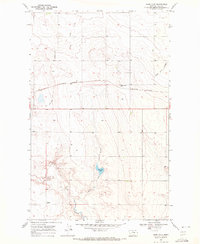
Sage Lake and the meandering course of Sage Creek define the northern drainage of this Hill County landscape, where the high plains are deeply incised by dry-wash coulees. The terrain is characterized by the erosive patterns of Faulkners Coulee and Halfway Coulee, which carve through the benchlands toward the Missouri River watershed further south. This 1969 survey, based on 1968 aerial photography, provides a clear view of the rural land management of the era, marked by numerous small-scale reservoirs and scattered wells that highlight the region's reliance on groundwater and seasonal runoff for livestock and agriculture in an arid environment.
Find a feature on this map
5 named features on this map. Tap any name to fly to it.
Don’t see what you’re looking for? This feature index may not catch every label — zoom into the map to look around manually.
Map Details
Editions of this 1969 Box Elder NW Map
This is the sole edition of this map. No revisions or reprints were ever made.
Other maps of this area

1904 · Boxelder
USGS Topo · 1:62,500

1906 · Kremlin
USGS Topo · 1:62,500

1906 · Boxelder
USGS Topo · 1:62,500

1919 · Big Sandy
USGS Topo · 1:125,000

1920 · Gildford
USGS Topo · 1:125,000

1943 · Gildford
USGS Topo · 1:125,000

1954 · Shelby
USGS Topo · 1:250,000

1958 · Shelby
USGS Topo · 1:250,000
1969 · Sage Lake
USGS Topo · 1:24,000
1969 · Kremlin
USGS Topo · 1:24,000