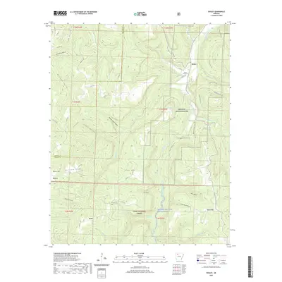
2020 Map of Boxley
USGS Topo · Published 2020About this map
Hurricane Ridge and Cave Mtn dominate this portion of the Ozark Highlands, where the Buffalo River carves a deep valley through the limestone and sandstone landscape. This area is defined by its preservation and heritage, containing sections of the Buffalo National River and the Ozark National Forest. The settlement pattern follows the drainage of the river and its many tributaries, such as Whiteley Creek and Beech Creek. Small communities and family landmarks are scattered throughout, including Boxley and Mossville, along with local burial grounds like Walnut Grove Cemetery and Whiteley Cemetery. The map captures an extensive network of footpaths and unpaved roads, notably the Buffalo River Trail and the Whiteley School Trail, which provide access to famous landmarks like Whitaker Point and the many hollows that dissect the surrounding plateaus.
Find a feature on this map
62 named features on this map. Tap any name to fly to it.
Don’t see what you’re looking for? This feature index may not catch every label — zoom into the map to look around manually.
Map Details
Editions of this 2020 Boxley Map
This is the sole edition of this map. No revisions or reprints were ever made.
Other maps of this area

1900 · Eureka Springs
USGS Topo · 1:125,000

1901 · Eureka Springs
USGS Topo · 1:125,000

1904 · Harrison
USGS Topo · 1:125,000

1905 · Harrison
USGS Topo · 1:125,000

1945 · Harrison
USGS Topo · 1:250,000

1949 · Harrison
USGS Topo · 1:250,000

1954 · Harrison
USGS Topo · 1:250,000

1956 · Russellville
USGS Topo · 1:250,000

1958 · Harrison
USGS Topo · 1:250,000

1964 · Russellville
USGS Topo · 1:250,000