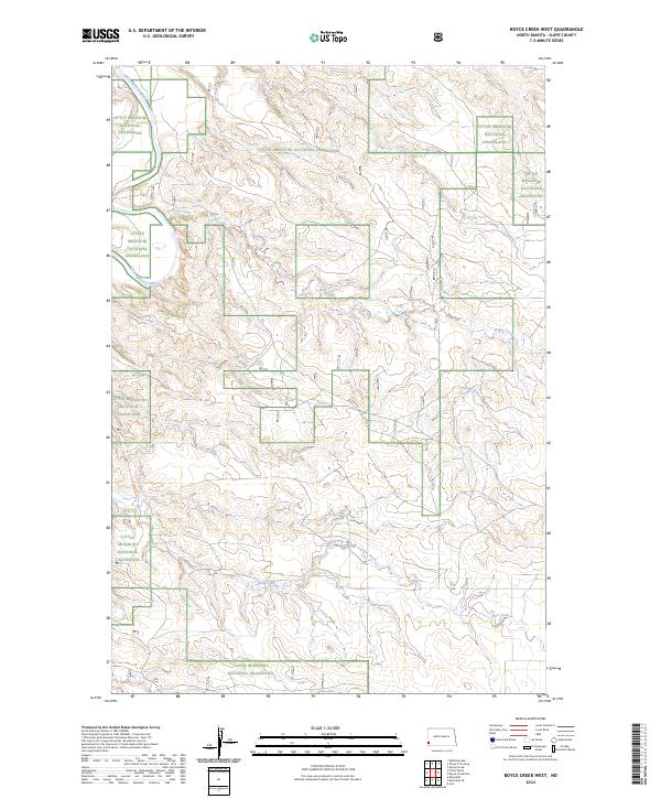
2024 Map of Boyce Creek West
USGS Topo · Published 2024About this map
Little Missouri National Grassland encompasses the majority of this landscape, where the broken terrain of the Badlands begins to define the drainage basins of the western plains. The meandering course of the Little Missouri River cuts through the northwest corner of the sheet, creating a riparian corridor that contrasts with the surrounding upland plateaus. This area, divided into the townships of t135n r105w, t135n r104w, t134n r105w, and t134n r104w, is primarily defined by its hydrological network. Major seasonal waterways like Boyce Creek and Cash Creek carve deep into the prairie sod, reflecting the erosional patterns characteristic of Slope County. The map provides a clear view of the public land survey system and the distinct boundaries between national grassland and private holdings in this sparsely populated region.
Find a feature on this map
8 named features on this map. Tap any name to fly to it.
Don’t see what you’re looking for? This feature index may not catch every label — zoom into the map to look around manually.
Map Details
Editions of this 2024 Boyce Creek West Map
This is the sole edition of this map. No revisions or reprints were ever made.
Other maps of this area

1953 · Dickinson
USGS Topo · 1:250,000

1957 · Dickinson
USGS Topo · 1:250,000

1979 · Three V Crossing
USGS Topo · 1:24,000

1979 · Ives
USGS Topo · 1:24,000

1980 · Spring Creek
USGS Topo · 1:24,000

1980 · Pretty Butte
USGS Topo · 1:24,000

1980 · Marmarth
USGS Topo · 1:24,000

1980 · Boyce Creek West
USGS Topo · 1:24,000

1980 · Belfield
USGS Topo · 1:100,000

1981 · Bowman
USGS Topo · 1:100,000