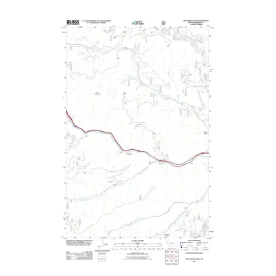
2011 Map of Boyd Mountain
USGS Topo · Published 2011About this map
The Saint Regis River corridor defines the geography of this Mineral County landscape, serving as a primary conduit for both transportation and water drainage. The settlement of Foraker sits near the riverbanks, where the historic Hiawatha and Mullan Rd follow the valley floor. To the north and south, the terrain rises sharply toward prominent features like Boyd Mountain and the high spine of Newman Ridge.
Find a feature on this map
20 named features on this map. Tap any name to fly to it.
Don’t see what you’re looking for? This feature index may not catch every label — zoom into the map to look around manually.
Map Details
Editions of this 2011 Boyd Mountain Map
This is the sole edition of this map. No revisions or reprints were ever made.
Other maps of this area

1918 · St Regis
USGS Topo · 1:125,000

1919 · St. Regis
USGS Topo · 1:125,000

1956 · St Regis
USGS Topo · 1:62,500

1956 · Wallace
USGS Topo · 1:250,000

1957 · Illinois Peak
USGS Topo · 1:62,500

1957 · Haugan
USGS Topo · 1:62,500

1957 · Simmons Peak
USGS Topo · 1:62,500

1960 · Wallace
USGS Topo · 1:250,000
1988 · St Regis
USGS Topo · 1:24,000
1988 · Torino Peak
USGS Topo · 1:24,000