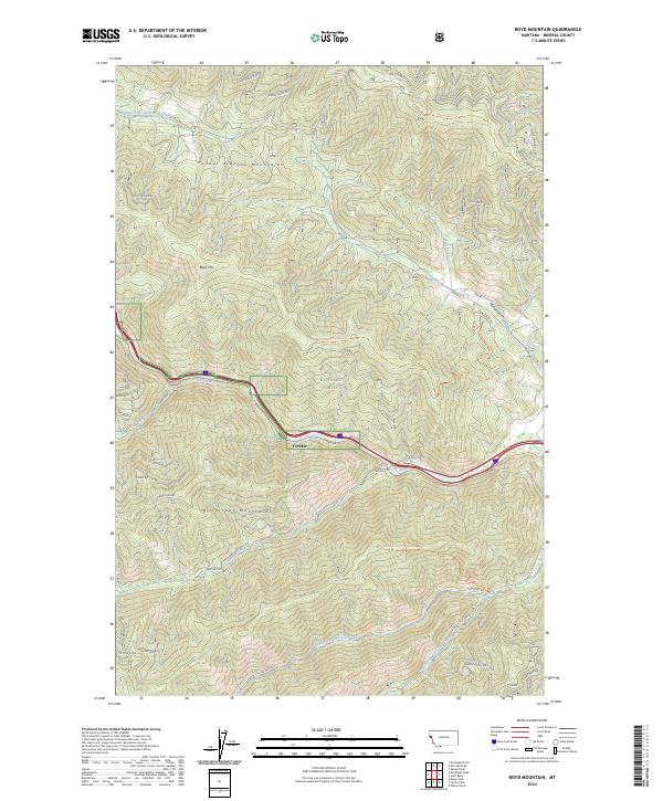
2024 Map of Boyd Mountain
USGS Topo · Published 2024About this map
The Coeur d'Alene Mountains and Bitterroot Mountains converge in this high-elevation corridor of the Lolo National Forest. The landscape is defined by the sharp descent of numerous drainages like Twomile Creek and Hendrickson Creek toward the central valley of the Saint Regis River. This river valley serves as the primary artery for transportation, carrying the modern interstate alongside historic routes such as the Rte Of The Olympian / Milwaukee Trl and the Saint Regis-River Hiawatha.
Find a feature on this map
52 named features on this map. Tap any name to fly to it.
Don’t see what you’re looking for? This feature index may not catch every label — zoom into the map to look around manually.
Map Details
Editions of this 2024 Boyd Mountain Map
This is the sole edition of this map. No revisions or reprints were ever made.
Other maps of this area

1918 · St Regis
USGS Topo · 1:125,000

1919 · St. Regis
USGS Topo · 1:125,000

1956 · St Regis
USGS Topo · 1:62,500

1956 · Wallace
USGS Topo · 1:250,000

1957 · Illinois Peak
USGS Topo · 1:62,500

1957 · Haugan
USGS Topo · 1:62,500

1957 · Simmons Peak
USGS Topo · 1:62,500

1960 · Wallace
USGS Topo · 1:250,000
1988 · St Regis
USGS Topo · 1:24,000
1988 · Torino Peak
USGS Topo · 1:24,000