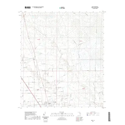
2021 Map of Boyd
USGS Topo · Published 2021About this map
Boyd and the northern outskirts of Perry anchor this North Florida landscape, where the flatlands of San Pedro Bay meet the intricate drainage of Rocky Creek and Spring Creek. The map documents a territory defined by timber and transit, marked by the Madison Main Line and various logging routes like the Paul Jefferies Logging Road and Main Bay Canal Grd. These features reveal the region's long-standing reliance on the logging industry to navigate and harvest the surrounding wetlands.
Find a feature on this map
98 named features on this map. Tap any name to fly to it.
Don’t see what you’re looking for? This feature index may not catch every label — zoom into the map to look around manually.
Map Details
Editions of this 2021 Boyd Map
This is the sole edition of this map. No revisions or reprints were ever made.
Other maps of this area

1952 · Secotan
USGS Topo · 1:24,000

1954 · Fenholloway
USGS Topo · 1:24,000

1954 · Boyd
USGS Topo · 1:24,000

1954 · Hampton Springs
USGS Topo · 1:24,000

1954 · Secotan
USGS Topo · 1:24,000

1954 · Day NW
USGS Topo · 1:24,000

1954 · Valdosta
USGS Topo · 1:250,000

1955 · Perry
USGS Topo · 1:24,000

1955 · Shady Grove
USGS Topo · 1:24,000

1955 · Greenville SE
USGS Topo · 1:24,000