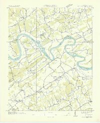
1935 Map of Boyds Creek
USGS Topo · Published 1935About this map
The French Broad River winds through the heart of this landscape, creating deep meanders like Frazier Bend and Underwood Bend that defined local agriculture and transport before modern infrastructure. Along its banks, the Huffaker Ferry provided a critical crossing point for residents of the Knox and Sevier County line. This 1935 examination shows a rural society organized around small crossroads and family names, where institutions like the Harrison Chilhowee Institute and the Seymour PO served as central hubs for the surrounding valleys.
Find a feature on this map
70 named features on this map. Tap any name to fly to it.
Don’t see what you’re looking for? This feature index may not catch every label — zoom into the map to look around manually.
Map Details
Editions of this 1935 Boyds Creek Map
2 editions found
Other maps of this area

1886 · Knoxville
USGS Topo · 1:125,000

1892 · Knoxville
USGS Topo · 1:125,000

1894 · Knoxville
USGS Topo · 1:125,000

1895 · Knoxville
USGS Topo · 1:125,000

1897 · Maynardville
USGS Topo · 1:125,000

1900 · Maynardville
USGS Topo · 1:125,000

1901 · Knoxville
USGS Topo · 1:125,000

1935 · Mascot
USGS Topo · 1:24,000

1935 · Knoxville
USGS Topo · 1:48,000

1935 · Straw Plains
USGS Topo · 1:48,000