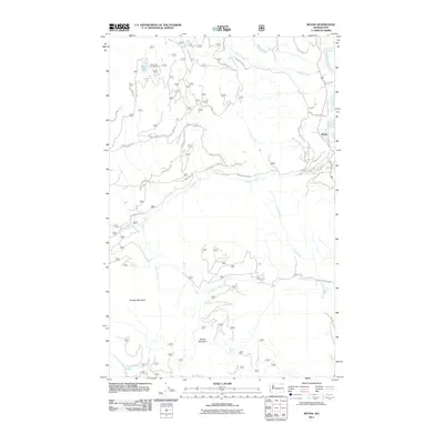
2011 Map of Boyds
USGS Topo · Published 2011About this map
Boyds sits at the northeastern edge of this Ferry County landscape, where the Kettle River defines the local drainage pattern. The topography is dominated by the massive presence of Hoodoo Mountain to the west and Bisbee Mountain to the south, separated by a complex network of drainages including Deadman Creek and Nancy Creek. This 2011 survey shows a terrain marked by forest service and county roads, reflecting a landscape where recreation and geography intersect. Significant water features like Davis Lake, home to the Davis Lake Campground, and Trout Lake provide clear landmarks for researchers. Local naming conventions are preserved in features such as Maggie Flts and Tie Camp Creek, while the road network, including Jackknife Lookout Rd and Deadman Creek Rd, provides insight into the accessibility of this mountainous region in the early 21st century.
Find a feature on this map
36 named features on this map. Tap any name to fly to it.
Don’t see what you’re looking for? This feature index may not catch every label — zoom into the map to look around manually.
Map Details
Editions of this 2011 Boyds Map
This is the sole edition of this map. No revisions or reprints were ever made.
Other maps of this area

1936 · Marcus
USGS Topo · 1:96,000

1942 · Marcus
USGS Topo · 1:125,000

1948 · Sherman Peak
USGS Topo · 1:62,500

1948 · Kettle Falls
USGS Topo · 1:62,500

1948 · Orient
USGS Topo · 1:62,500

1948 · Togo Mountain
USGS Topo · 1:62,500

1951 · Togo Mountain
USGS Topo · 1:62,500

1951 · Sherman Peak
USGS Topo · 1:62,500

1951 · Orient
USGS Topo · 1:62,500

1951 · Kettle Falls
USGS Topo · 1:62,500