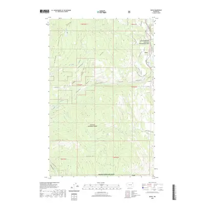
2020 Map of Boyds
USGS Topo · Published 2020About this map
Boyds sits at the northeastern edge of this Ferry County landscape, where the waters of the Columbia River are preserved within the Lake Roosevelt National Recreation Area. The terrain is defined by the high elevations of the Colville National Forest, stretching from the crest of Thompson Ridge in the west to the slopes of Bisbee Mtn and Hoodoo Mtn in the south. This modern survey illustrates a network of forest roads and land management areas, including the Sherman Creek Game Range near the southern border.
Find a feature on this map
49 named features on this map. Tap any name to fly to it.
Don’t see what you’re looking for? This feature index may not catch every label — zoom into the map to look around manually.
Map Details
Editions of this 2020 Boyds Map
This is the sole edition of this map. No revisions or reprints were ever made.
Other maps of this area

1936 · Marcus
USGS Topo · 1:96,000

1942 · Marcus
USGS Topo · 1:125,000

1948 · Sherman Peak
USGS Topo · 1:62,500

1948 · Kettle Falls
USGS Topo · 1:62,500

1948 · Orient
USGS Topo · 1:62,500

1948 · Togo Mountain
USGS Topo · 1:62,500

1951 · Togo Mountain
USGS Topo · 1:62,500

1951 · Sherman Peak
USGS Topo · 1:62,500

1951 · Orient
USGS Topo · 1:62,500

1951 · Kettle Falls
USGS Topo · 1:62,500