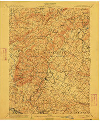
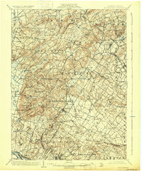
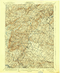
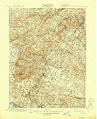
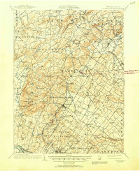
1902 Map of Boyertown
USGS Topo · Published 1912About this map
The Boyertown iron-ore region and the industrial landscape of the Schuylkill River corridor are clearly defined at the start of the twentieth century. This area, spanning the borders of Berks, Lehigh, and Montgomery Counties, shows a dense network of nineteenth-century infrastructure, including the Perkiomen R.R. and the Philadelphia & Reading R.R.. Local life centers on established villages like Bechtelsville and New Berlinsville, while landmarks such as Huffs Church and Hill Church provide key reference points for genealogical research. The terrain is marked by distinctive formations like Rittenhouse Gap and the geologic curiosity of Ringing Rock Park near Pottstown. The map reveals the relationship between the upland settlements, such as Landis Store and Fredericksville, and the developing rail hubs that served the region's agricultural and mining interests.
Find a feature on this map
129 named features on this map. Tap any name to fly to it.
Don’t see what you’re looking for? This feature index may not catch every label — zoom into the map to look around manually.
Map Details
Editions of this 1902 Boyertown Map
9 editions found
Other maps of this area

1888 · Quakertown
USGS Topo · 1:62,500

1890 · Quakertown
USGS Topo · 1:62,500

1894 · Reading
USGS Topo · 1:62,500

1894 · Allentown
USGS Topo · 1:62,500

1894 · Quakertown
USGS Topo · 1:62,500

1894 · Norristown
USGS Topo · 1:62,500

1895 · Norristown
USGS Topo · 1:62,500

1896 · Norristown
USGS Topo · 1:62,500

1902 · Boyertown
USGS Topo · 1:62,500

1902 · Slatington
USGS Topo · 1:62,500
Featured Places
- Pottstown, PA
- Limerick Township, PA
- New Hanover Township, PA
- Maxatawny Township, PA
- Longswamp Township, PA