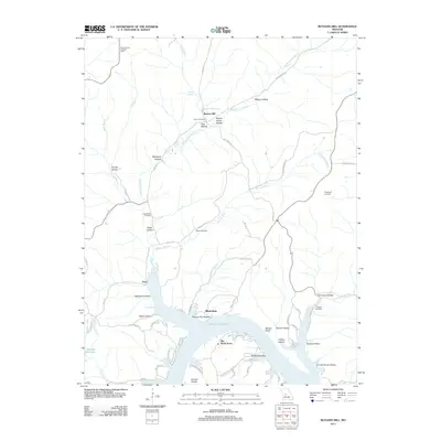
2011 Map of Boylers Mill
USGS Topo · Published 2011About this map
Boylers Mill and its namesake spring anchor this landscape in the northern Ozarks, where the terrain transitions from rugged creek valleys to the sprawling shoreline of Lake of the Ozarks. This 2011 survey captures a mix of traditional rural settlements like Zora and the modern residential patterns found at Big Bend Acres and Riverview. The geography is defined by a dense network of hollows, including School House Hollow and Possum Trot Hollow, which lead toward the central waterway of Big Buffalo Creek. Genealogists will find a high concentration of local history markers, including Frisch Cemetery, Shiloh Cemetery, and Franklin Cemetery. Higher elevations are marked by the Mount Hulda Lookout Tower, providing a strategic view over the heavily forested ridges and the winding inlets of Big Buffalo Cove.
Find a feature on this map
71 named features on this map. Tap any name to fly to it.
Don’t see what you’re looking for? This feature index may not catch every label — zoom into the map to look around manually.
Map Details
Editions of this 2011 Boylers Mill Map
This is the sole edition of this map. No revisions or reprints were ever made.
Other maps of this area

1887 · Warsaw
USGS Topo · 1:125,000

1888 · Versailles
USGS Topo · 1:125,000

1893 · Versailles
USGS Topo · 1:125,000

1894 · Warsaw
USGS Topo · 1:125,000

1904 · Gravois Mills
USGS Topo · 1:62,500

1934 · Irontown Ferry
USGS Topo · 1:24,000

1935 · Proctor Creek
USGS Topo · 1:24,000

1935 · Edwards
USGS Topo · 1:24,000

1935 · Boylers Mill
USGS Topo · 1:24,000

1935 · Knobby Creek
USGS Topo · 1:24,000