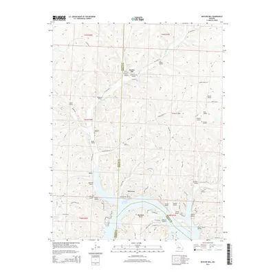
2014 Map of Boylers Mill
USGS Topo · Published 2014About this map
Boylers Mill sits near the northern boundary of this Missouri landscape, where the waters of Boylers Mill Spring and Hudson Spring feed into the intricate drainage system of Big Buffalo Cr. The southern portion of the area is dominated by the sprawling shoreline of the Lake of the Ozarks, where residential developments like Big Bend Acres and Riverview have emerged along the complex peninsulas and inlets. This modern survey illustrates the transition from traditional upland settlements to recreation-focused lakefront communities.
Find a feature on this map
84 named features on this map. Tap any name to fly to it.
Don’t see what you’re looking for? This feature index may not catch every label — zoom into the map to look around manually.
Map Details
Editions of this 2014 Boylers Mill Map
This is the sole edition of this map. No revisions or reprints were ever made.
Other maps of this area

1887 · Warsaw
USGS Topo · 1:125,000

1888 · Versailles
USGS Topo · 1:125,000

1893 · Versailles
USGS Topo · 1:125,000

1894 · Warsaw
USGS Topo · 1:125,000

1904 · Gravois Mills
USGS Topo · 1:62,500

1934 · Irontown Ferry
USGS Topo · 1:24,000

1935 · Proctor Creek
USGS Topo · 1:24,000

1935 · Edwards
USGS Topo · 1:24,000

1935 · Boylers Mill
USGS Topo · 1:24,000

1935 · Knobby Creek
USGS Topo · 1:24,000