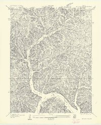
1957 Map of Boylers Mill
USGS Topo · Published 1957About this map
Boylers Mill serves as a focal point in this 1935 survey, situated where the terrain meets the northern reaches of the Lake of the Ozarks. The map captures a moment when the landscape was defined by its drainage into Big Buffalo Creek and Little Buffalo Creek, with local life centered around the Big Buffalo School and Riverview School. The intricate topography of the Ozark hills is revealed through numerous named drainages such as Possum Hollow and Brewer Hollow, highlighting a period before modernization significantly altered these rural connections.
Find a feature on this map
19 named features on this map. Tap any name to fly to it.
Don’t see what you’re looking for? This feature index may not catch every label — zoom into the map to look around manually.
Map Details
Editions of this 1957 Boylers Mill Map
This is the sole edition of this map. No revisions or reprints were ever made.
Other maps of this area

1887 · Warsaw
USGS Topo · 1:125,000

1888 · Versailles
USGS Topo · 1:125,000

1893 · Versailles
USGS Topo · 1:125,000

1894 · Warsaw
USGS Topo · 1:125,000

1904 · Gravois Mills
USGS Topo · 1:62,500

1934 · Irontown Ferry
USGS Topo · 1:24,000

1935 · Proctor Creek
USGS Topo · 1:24,000

1935 · Edwards
USGS Topo · 1:24,000

1935 · Boylers Mill
USGS Topo · 1:24,000

1935 · Knobby Creek
USGS Topo · 1:24,000