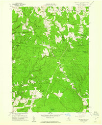
1959 Map of Boylston Center
USGS Topo · Published 1961About this map
Boylston Center and its surrounding hamlets occupy this landscape on the border of Oswego and Jefferson counties during the late 1950s. The region is defined by extensive public lands, including the Lorraine State Reforestation Area and the Littlejohn State Game Management Area, suggesting a transition from earlier agricultural use to managed conservation and recreation. Small clusters of rural life persist at Smartville, Greenboro, and Frederick Corners, connected by a network of winding roads like Lorraine-Worth Center Road.
Find a feature on this map
56 named features on this map. Tap any name to fly to it.
Don’t see what you’re looking for? This feature index may not catch every label — zoom into the map to look around manually.
Map Details
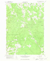
Editions of this 1959 Boylston Center Map

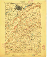
Other maps of this area

1893 · Sackets Harbor
USGS Topo · 1:62,500

1895 · Sacketts Harbor
USGS Topo · 1:62,500

1895 · Pulaski
USGS Topo · 1:62,500

1895 · Watertown
USGS Topo · 1:62,500

1898 · Watertown
USGS Topo · 1:62,500

1903 · Orwell
USGS Topo · 1:62,500

1905 · Orwell
USGS Topo · 1:62,500

1908 · Watertown
USGS Topo · 1:62,500
1909 · Watertown
USGS Topo · 1:62,500

1942 · Sandy Creek
USGS Topo · 1:24,000