
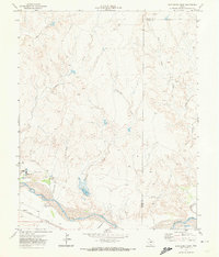
1971 Map of Boys Ranch West
USGS Topo · Published 1974About this map
The Canadian River valley dominates this portion of the Texas Panhandle, where the rugged breaks of the Llano Estacado meet the riparian corridor. The settlement of Boys Ranch serves as a primary hub of activity, featuring a Rodeo Ground, Landing Strips, and a concentrated infrastructure including a Substa and multiple wells. This landscape is deeply tied to the cattle industry and early frontier history, evidenced by the presence of Tascosa and its associated Boot Hill Cem.
Find a feature on this map
31 named features on this map. Tap any name to fly to it.
Don’t see what you’re looking for? This feature index may not catch every label — zoom into the map to look around manually.
Map Details
Editions of this 1971 Boys Ranch West Map
This is the sole edition of this map. No revisions or reprints were ever made.
Other maps of this area

1934 · Ady
USGS Topo · 1:62,500

1936 · Ady
USGS Topo · 1:62,500

1954 · Tucumcari
USGS Topo · 1:250,000

1958 · Tucumcari
USGS Topo · 1:250,000

1966 · Halfway Creek
USGS Topo · 1:24,000

1966 · Ady
USGS Topo · 1:24,000

1966 · Torrea Peak
USGS Topo · 1:24,000

1971 · Bivins Channing Ranch
USGS Topo · 1:24,000

1971 · Channing NW
USGS Topo · 1:24,000
1971 · Boys Ranch East
USGS Topo · 1:24,000