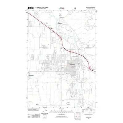
2011 Map of Bozeman
USGS Topo · Published 2011About this map
Bozeman serves as the focal point of this 2011 survey, showing the city's modern layout alongside historical agricultural roots. The extensive campus of Montana State University occupies the southern reach of the city, while several large cemeteries, including Sunset Hills Cemetery, Brondel Catholic Cemetery, and Holy Rosary Cemetery, mark the town’s periphery and record its generational history. The landscape transitions from the urban grid to working lands like the Patterson Ranch and Beck Ranch, reflecting the region's enduring ranching legacy.
Find a feature on this map
51 named features on this map. Tap any name to fly to it.
Don’t see what you’re looking for? This feature index may not catch every label — zoom into the map to look around manually.
Map Details
Editions of this 2011 Bozeman Map
This is the sole edition of this map. No revisions or reprints were ever made.
Other maps of this area

1888 · Three Forks
USGS Topo · 1:250,000

1891 · Livingston
USGS Topo · 1:250,000

1893 · Livingston
USGS Topo · 1:250,000

1894 · Three Forks
USGS Topo · 1:250,000

1895 · Three Forks
USGS Topo · 1:250,000

1947 · Bozeman
USGS Topo · 1:250,000

1948 · Bozeman
USGS Topo · 1:250,000

1950 · Belgrade
USGS Topo · 1:62,500

1951 · Bozeman Pass
USGS Topo · 1:62,500

1951 · Sedan
USGS Topo · 1:62,500