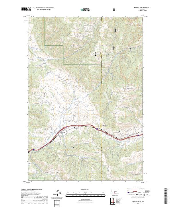
2024 Map of Bozeman Pass
USGS Topo · Published 2024About this map
Bozeman Pass serves as the topographic and historical centerpiece of this mountain landscape, marking the divide where Montana Rail Link and Interstate 90 traverse the gap between the Bridger Range and the foothills of the Gallatin National Forest. This modern survey documents the high-altitude transit corridor near West End and Muir, tracing the headwaters of Billman Creek and Rocky Creek. The mapping of small, family-associated or community burial sites like Vater's Cem, Muir Cem, and Timberline Cem provides essential spatial data for local historians and genealogists. Numerous mountain trails and specialized roads, such as Carrie Nye Trl and Mountain Moose, crisscross the ridges, reflecting the area's contemporary role as a gateway for outdoor recreation and forest management between Gallatin and Park counties.
Find a feature on this map
84 named features on this map. Tap any name to fly to it.
Don’t see what you’re looking for? This feature index may not catch every label — zoom into the map to look around manually.
Map Details
Editions of this 2024 Bozeman Pass Map
This is the sole edition of this map. No revisions or reprints were ever made.
Other maps of this area

1891 · Livingston
USGS Topo · 1:250,000

1893 · Livingston
USGS Topo · 1:250,000

1947 · Bozeman
USGS Topo · 1:250,000

1948 · Bozeman
USGS Topo · 1:250,000

1951 · Bozeman Pass
USGS Topo · 1:62,500

1951 · Gobblers Knob
USGS Topo · 1:24,000

1951 · Hoppers
USGS Topo · 1:24,000

1951 · Chimney Rock
USGS Topo · 1:24,000

1951 · Sedan
USGS Topo · 1:62,500

1955 · Bozeman
USGS Topo · 1:250,000