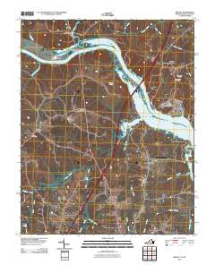
2010 Map of Bracey
USGS Topo · Published 2010About this map
Lake Gaston dominates the landscape of this Mecklenburg County border region, where the Roanoke River system forms the boundary between Virginia and North Carolina. The map captures the area during a period of established residential and recreational development centered around the reservoir, yet it retains clear evidence of its older agrarian and transportation foundations. Long-standing local identifiers like Beechwood, Palmer Crossroads, and Palmer Springs persist alongside newer landmarks such as the River Ridge Dam.
Find a feature on this map
29 named features on this map. Tap any name to fly to it.
Don’t see what you’re looking for? This feature index may not catch every label — zoom into the map to look around manually.
Map Details
Editions of this 2010 Bracey Map
This is the sole edition of this map. No revisions or reprints were ever made.
Other maps of this area

1953 · Greensboro
USGS Topo · 1:250,000

1954 · Greensboro
USGS Topo · 1:250,000

1955 · Boydton
USGS Topo · 1:62,500

1962 · Greensboro
USGS Topo · 1:250,000

1966 · Greensboro
USGS Topo · 1:250,000

1968 · South Hill SE
USGS Topo · 1:24,000

1968 · Bracey
USGS Topo · 1:24,000

1968 · John H Kerr Dam
USGS Topo · 1:24,000
1968 · La Crosse
USGS Topo · 1:24,000
1968 · Baskerville
USGS Topo · 1:24,000