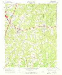
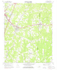
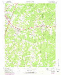
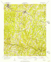
1968 Map of La Crosse
USGS Topo · Published 1972About this map
Mecklenburg County and Brunswick County converge on this 1960s survey, highlighting the vital rail junctions at La Crosse and Brodnax. The Seaboard Coast Line and Norfolk and Western tracks bisect the landscape, dictating the growth of towns and the distribution of rural commerce. This era shows a community structured around its local institutions, with numerous houses of worship such as Little Bethel Ch, Sardis Ch, and Olive Branch Ch scattered across the countryside.
Find a feature on this map
44 named features on this map. Tap any name to fly to it.
Don’t see what you’re looking for? This feature index may not catch every label — zoom into the map to look around manually.
Map Details
Editions of this 1968 La Crosse Map
3 editions found
Other maps of this area

1918 · Lawrenceville
USGS Topo · 1:62,500

1919 · White Plains
USGS Topo · 1:48,000

1920 · Lawrenceville
USGS Topo · 1:48,000

1920 · White Plains
USGS Topo · 1:62,500

1921 · Lawrenceville
USGS Topo · 1:62,500

1942 · Lawrenceville
USGS Topo · 1:62,500

1953 · Norfolk
USGS Topo · 1:250,000

1953 · Greensboro
USGS Topo · 1:250,000

1954 · Greensboro
USGS Topo · 1:250,000
1955 · Kenbridge
USGS Topo · 1:62,500