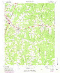
1968 Map of La Crosse
USGS Topo · Published 1982About this map
The railroad junction at La Crosse serves as the focal point for this Southern Virginia landscape, where the Seaboard Coast Line and the Norfolk and Danville rail lines intersect. In the late 1960s and early 1980s, the region maintained its rural character, defined by a dense network of country churches like Union Meherrin Ch and Miles Chapel. Significant infrastructure such as the Mecklenburg-Brunswick Regional Airport and a Sewage Disposal Pond near the Booker-Boyd Sch suggest the gradual modernization of the area between South Hill and Brodnax. The terrain is deeply etched by a complex drainage system including Evans Creek and Miles Creek, which likely dictated early settlement patterns and the placement of small rural communities like Blackridge and Marengo. Genealogical researchers can trace numerous family-named landmarks and church sites, such as Mt Herman Ch and Sardis Ch, which anchored these tobacco-growing communities across the Mecklenburg and Brunswick county line.
Find a feature on this map
55 named features on this map. Tap any name to fly to it.
Don’t see what you’re looking for? This feature index may not catch every label — zoom into the map to look around manually.
Map Details
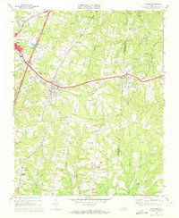
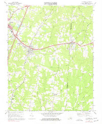
Editions of this 1968 La Crosse Map
3 editions found
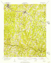
Other maps of this area

1918 · Lawrenceville
USGS Topo · 1:62,500

1919 · White Plains
USGS Topo · 1:48,000

1920 · Lawrenceville
USGS Topo · 1:48,000

1920 · White Plains
USGS Topo · 1:62,500

1921 · Lawrenceville
USGS Topo · 1:62,500

1942 · Lawrenceville
USGS Topo · 1:62,500

1953 · Norfolk
USGS Topo · 1:250,000

1953 · Greensboro
USGS Topo · 1:250,000

1954 · Greensboro
USGS Topo · 1:250,000
1955 · Kenbridge
USGS Topo · 1:62,500