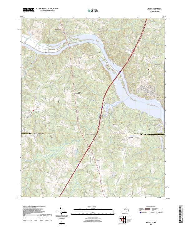
2022 Map of Bracey
USGS Topo · Published 2022About this map
Lake Gaston serves as the central geographic feature of this borderlands region, where the Virginia and North Carolina state line bisects the landscape. The reservoir dominates the center of the sheet, surrounded by several established communities such as Beechwood, Palmer Crossroads, and Palmer Springs. The presence of Grace Cem, Saint Marks Cem, and Kingswood Cem offers critical touchpoints for family historians tracing roots through Mecklenburg and Warren counties.
Find a feature on this map
87 named features on this map. Tap any name to fly to it.
Don’t see what you’re looking for? This feature index may not catch every label — zoom into the map to look around manually.
Map Details
Editions of this 2022 Bracey Map
This is the sole edition of this map. No revisions or reprints were ever made.
Other maps of this area

1953 · Greensboro
USGS Topo · 1:250,000

1954 · Greensboro
USGS Topo · 1:250,000

1955 · Boydton
USGS Topo · 1:62,500

1962 · Greensboro
USGS Topo · 1:250,000

1966 · Greensboro
USGS Topo · 1:250,000

1968 · South Hill SE
USGS Topo · 1:24,000

1968 · Bracey
USGS Topo · 1:24,000

1968 · John H Kerr Dam
USGS Topo · 1:24,000
1968 · La Crosse
USGS Topo · 1:24,000
1968 · Baskerville
USGS Topo · 1:24,000