1977 Map of Bracey
USGS Topo · Published 1979About this map
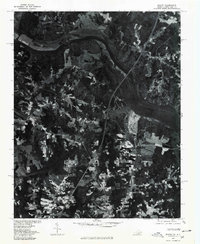
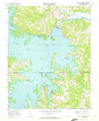
Lake Gaston dominates this 1977 orthophotoquad, where the massive impoundment of the Roanoke River straddles the border between Virginia and North Carolina. This aerial perspective, prepared in cooperation with the North Carolina Department of Natural and Economic Resources, reveals the intricate shoreline and surrounding timberland during a period of significant recreational and residential development. The map details established communities such as Bracey and Palmer Springs, alongside smaller settlements like Beechwood and Paschall. The imagery provides a clear view of the transportation corridors and land-use patterns typical of the Southside Virginia region in the late 1970s, showing the contrast between the expansive waters of the reservoir and the agricultural clearings that define the local topography.
Find a feature on this map
6 named features on this map. Tap any name to fly to it.
Don’t see what you’re looking for? This feature index may not catch every label — zoom into the map to look around manually.
Map Details
Editions of this 1977 Bracey Map
This is the sole edition of this map. No revisions or reprints were ever made.
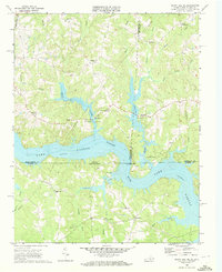
Other maps of this area

1953 · Greensboro
USGS Topo · 1:250,000

1954 · Greensboro
USGS Topo · 1:250,000
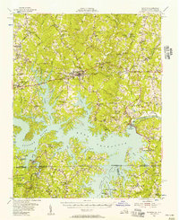
1955 · Boydton
USGS Topo · 1:62,500

1962 · Greensboro
USGS Topo · 1:250,000

1966 · Greensboro
USGS Topo · 1:250,000
1968 · South Hill SE
USGS Topo · 1:24,000
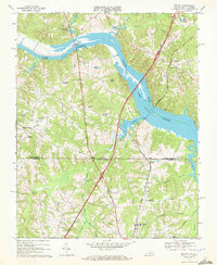
1968 · Bracey
USGS Topo · 1:24,000
1968 · John H Kerr Dam
USGS Topo · 1:24,000
1968 · La Crosse
USGS Topo · 1:24,000
1968 · Baskerville
USGS Topo · 1:24,000