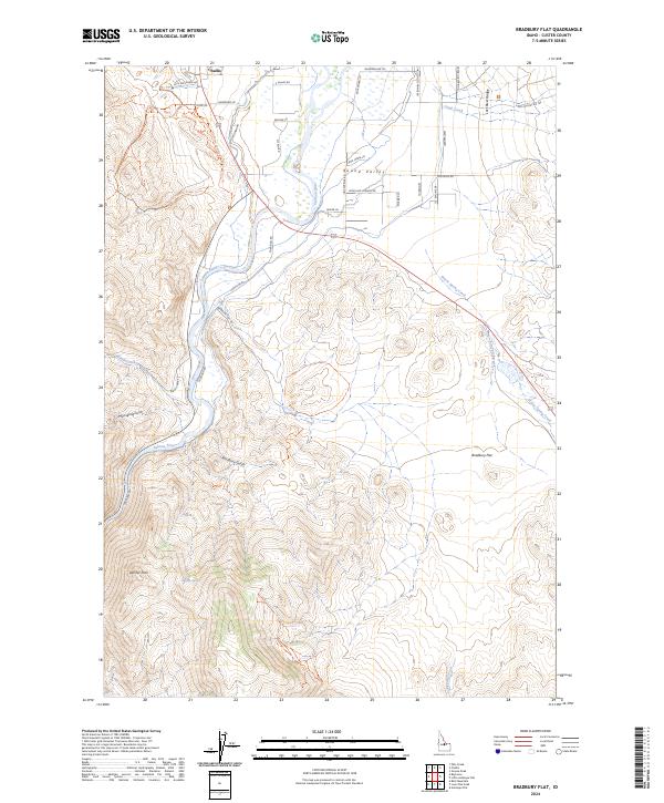
2024 Map of Bradbury Flat
USGS Topo · Published 2024About this map
Challis sits at the northern edge of this Idaho landscape, where the high desert terrain meets the carved path of the Salmon River. The geography is defined by the broad, flat expanses of Round Valley and the namesake Bradbury Flat, offering a clear view of the complex irrigation and access network developed in this corner of Custer County. These level areas are bounded by significant elevation changes, from the rising slopes of the Lost River Range in the northeast to the high plateau of Germer Park in the southwest.
Find a feature on this map
45 named features on this map. Tap any name to fly to it.
Don’t see what you’re looking for? This feature index may not catch every label — zoom into the map to look around manually.
Map Details
Editions of this 2024 Bradbury Flat Map
This is the sole edition of this map. No revisions or reprints were ever made.
Other maps of this area

1929 · Bayhorse
USGS Topo · 1:125,000

1956 · Challis
USGS Topo · 1:62,500

1956 · Twin Peaks
USGS Topo · 1:62,500

1957 · Challis
USGS Topo · 1:250,000

1960 · Challis
USGS Topo · 1:250,000

1963 · Challis
USGS Topo · 1:250,000

1963 · Bald Mountain
USGS Topo · 1:24,000

1963 · Bayhorse
USGS Topo · 1:24,000
1963 · Little Antelope Flat
USGS Topo · 1:24,000

1963 · Clayton
USGS Topo · 1:62,500