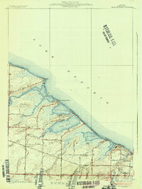
1934 Map of Braddock Heights
USGS Topo · Published 1934About this map
Lake Ontario shapes the northern edge of this 1930s coastal landscape, where a series of large ponds and bays define the shoreline of Greece. The map illustrates a developed seasonal and residential lakefront, with narrow strips of land separating the water from the interior. Locations like Manitou Beach, Grand View Beach, and Island Cottage Beach indicate a thriving shoreline culture during this era. Inland, the map reveals a different character dominated by agriculture and local schools, including Sch No 13 and Frisbee Hill Sch. The presence of Greece Sta and a network of well-defined roads like Latta Road and Ridge Road show how the area connected back to the growing suburban and rural hubs of Monroe County. Significant natural features such as Braddock Bay, Cranberry Pond, and Long Pond dominate the topography, providing a detailed record of the wetlands and points like Beatty Point before modern development further altered the drainage patterns of Salmon Creek and Buttonwood Creek.
Find a feature on this map
59 named features on this map. Tap any name to fly to it.
Don’t see what you’re looking for? This feature index may not catch every label — zoom into the map to look around manually.
Map Details
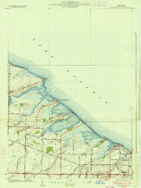
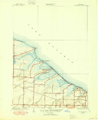
Editions of this 1934 Braddock Heights Map
Other maps of this area

1895 · Rochester
USGS Topo · 1:62,500

1895 · Ontario Beach
USGS Topo · 1:62,500

1898 · Rochester
USGS Topo · 1:62,500

1899 · Hamlin
USGS Topo · 1:62,500

1899 · Ontario Beach
USGS Topo · 1:62,500

1899 · Brockport
USGS Topo · 1:62,500

1912 · Rochester
USGS Topo · 1:62,500

1912 · Ontario Beach
USGS Topo · 1:62,500

1920 · Rochester
USGS Topo · 1:62,500

1931 · Rochester West
USGS Topo · 1:24,000