
1944 Map of Bradenton Beach
USGS Topo · Published 1944About this map
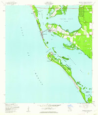
Anna Maria Key and Longboat Key dominate this wartime coastal survey, revealing the barrier island landscape before the era of intensive high-rise development. The settlement of Bradenton Beach serves as a central hub, connected to the mainland village of Cortez via the Cortez Bridge. Further north, the small community of Ilexhurst sits near the northern tip of the key, while Longbeach occupies the northern end of Longboat Key across the Longboat Inlet. The influence of the Second World War is evident on the landscape, specifically with the presence of the Army Firing Range and the Longboat Landing Strip positioned along the narrow stretch of the southern key. This map documents a transitional period for Manatee Co, showing early residential plats like Palma Sola Park alongside established maritime markers like Light 15 and Light 16A.
Find a feature on this map
48 named features on this map. Tap any name to fly to it.
Don’t see what you’re looking for? This feature index may not catch every label — zoom into the map to look around manually.
Map Details
Editions of this 1944 Bradenton Beach Map
2 editions found
Other maps of this area

1921 · Fort De Soto
USGS Topo · 1:62,500

1944 · Egmont Key
USGS Topo · 1:31,680

1944 · Sarasota
USGS Topo · 1:31,680

1944 · Anna Maria
USGS Topo · 1:31,680

1944 · Ellenton
USGS Topo · 1:31,680

1947 · Bradenton
USGS Topo · 1:24,000

1956 · Tampa
USGS Topo · 1:250,000

1959 · Tampa
USGS Topo · 1:250,000

1960 · Tampa
USGS Topo · 1:250,000
1964 · Palmetto
USGS Topo · 1:24,000
Featured Places
- Bradenton, FL
- Longboat Key, FL
- Holmes Beach, FL
- Bradenton Beach, Brandenton Beach
- Longbeach, Longboat Key