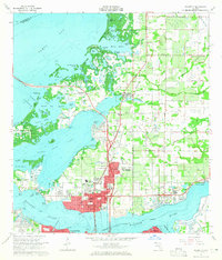
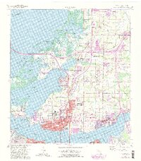
1964 Map of Palmetto
USGS Topo · Published 1965About this map
Palmetto and its surrounding communities sit at a busy intersection of mid-century infrastructure and coastal geography. This 1964 survey captures the urban core of Palmetto alongside growing residential areas like Memphis and Memphis Heights, while the Sunshine Skyway carries traffic across the complex waterways of Tampa Bay and Terra Ceia Bay. Local landmarks like the Lincoln Memorial Sch and the Manatee Agricultural Center (Fairgrounds) serve as anchors for the community. The landscape is deeply tied to the water, defined by intricate systems of bayous and inlets such as Alderman Bayou and Williams Bayou. In the eastern sections, the Atlantic Coast Line Railroad and Seaboard Air Line Railroad converge near Ellenton, where an active Quarry and the Ellenton Airport illustrate the era's local industry and transportation network.
Find a feature on this map
87 named features on this map. Tap any name to fly to it.
Don’t see what you’re looking for? This feature index may not catch every label — zoom into the map to look around manually.
Map Details
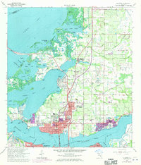
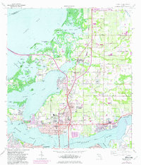
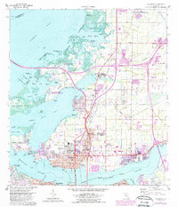
Editions of this 1964 Palmetto Map
5 editions found
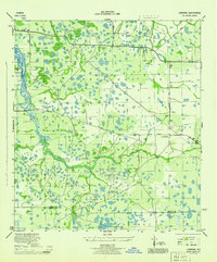
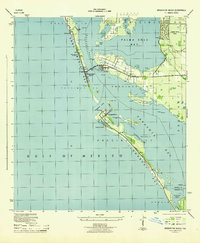
Other maps of this area

1921 · Fort De Soto
USGS Topo · 1:62,500

1942 · Cockroach Bay
USGS Topo · 1:31,680

1943 · Pass-A-Grille
USGS Topo · 1:31,680
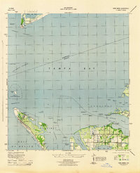
1944 · Anna Maria
USGS Topo · 1:31,680

1944 · Ruskin
USGS Topo · 1:31,680
1944 · Lorraine
USGS Topo · 1:31,680

1944 · Ellenton
USGS Topo · 1:31,680

1944 · Parish
USGS Topo · 1:31,680
1944 · Bradenton Beach
USGS Topo · 1:31,680

1945 · Cockroach Bay
USGS Topo · 1:31,680