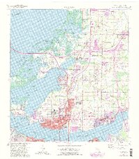
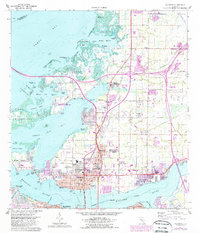
1964 Map of Palmetto
USGS Topo · Published 1987About this map
Terra Ceia Island and the northern banks of the Manatee River dominate this coastal landscape, where the ancient history of the Madira Bickel Mound State Archaeological Site meets mid-century suburban expansion. The city of Palmetto serves as a hub, showing a dense grid of streets, the Manatee Agricultural Center (Fairgrounds), and the Lincoln Memorial Sch. To the north, the terrain transitions into a complex network of bayous and inlets, including Tillette Bayou and Williams Bayou, reflecting the area's maritime dependence before extensive modern development. The transportation network is anchored by the Sunshine Skyway and the Seaboard Coast Line railroad, which historically connected these citrus and agricultural communities. Small settlements like Gillette and Rubonia are visible alongside larger cemeteries and parks such as Mansion Memorial Park, providing valuable data for family historians tracing roots in Manatee County.
Find a feature on this map
87 named features on this map. Tap any name to fly to it.
Don’t see what you’re looking for? This feature index may not catch every label — zoom into the map to look around manually.
Map Details
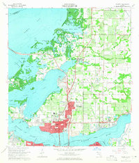
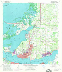
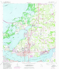
Editions of this 1964 Palmetto Map
5 editions found
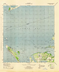
Other maps of this area

1921 · Fort De Soto
USGS Topo · 1:62,500

1942 · Cockroach Bay
USGS Topo · 1:31,680

1943 · Pass-A-Grille
USGS Topo · 1:31,680
1944 · Anna Maria
USGS Topo · 1:31,680

1944 · Ruskin
USGS Topo · 1:31,680
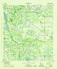
1944 · Lorraine
USGS Topo · 1:31,680

1944 · Ellenton
USGS Topo · 1:31,680

1944 · Parish
USGS Topo · 1:31,680
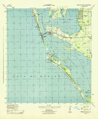
1944 · Bradenton Beach
USGS Topo · 1:31,680

1945 · Cockroach Bay
USGS Topo · 1:31,680