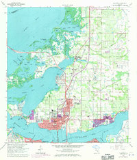
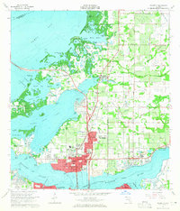
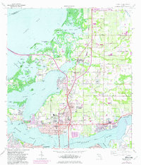
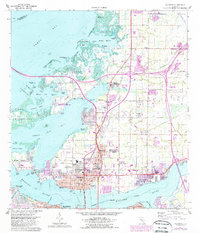
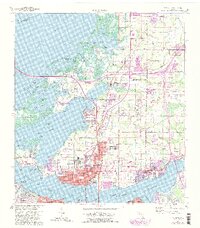
1964 Map of Palmetto
USGS Topo · Published 1970About this map
The Manatee River shoreline and the coastal communities of Palmetto and Ellenton dominate this mid-century survey, which documents a landscape transitioning from agricultural roots to modern suburban growth. Significant historical landmarks are present, including the Bickel Mound Park and the grounds of the Manatee Agricultural Center (Fairgrounds). Educational and community centers such as Lincoln Memorial High Sch and Palm View Sch appear alongside established neighborhoods like Memphis and Memphis Heights.
Find a feature on this map
97 named features on this map. Tap any name to fly to it.
Don’t see what you’re looking for? This feature index may not catch every label — zoom into the map to look around manually.
Map Details
Editions of this 1964 Palmetto Map
5 editions found
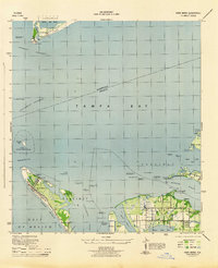
Other maps of this area

1921 · Fort De Soto
USGS Topo · 1:62,500

1942 · Cockroach Bay
USGS Topo · 1:31,680

1943 · Pass-A-Grille
USGS Topo · 1:31,680
1944 · Anna Maria
USGS Topo · 1:31,680

1944 · Ruskin
USGS Topo · 1:31,680
1944 · Lorraine
USGS Topo · 1:31,680

1944 · Ellenton
USGS Topo · 1:31,680

1944 · Parish
USGS Topo · 1:31,680
1944 · Bradenton Beach
USGS Topo · 1:31,680

1945 · Cockroach Bay
USGS Topo · 1:31,680