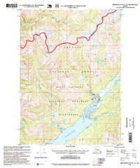
1995 Map of Bradfield Canal A-4
USGS Topo · Published 1999About this map
Burroughs Bay and the tidal reaches of the Unuk River anchor this Alaskan coastal landscape, where the Misty Fiords National Monument Wilderness meets the Tongass National Forest. The map documents a sparsely inhabited terrain of steep mountains and glacier-fed drainage systems, defined by the confluence of major waterways like the Eulachon River and Klahini River. Human presence is concentrated near the river mouths and shoreline, evidenced by small coastal outposts such as Bishop Ranch, Matney Ranch, and the Burroughs Bay North Base. A significant administrative line, the Wilderness Boundary, separates the protected monument lands from the surrounding forest, following the high ridges from Spur Mountain through the drainage of Grant Creek. The mapping of these remote ranch and cabin sites provides a valuable record of land use in the Ketchikan and Wrangell areas during the late 20th century.
Find a feature on this map
19 named features on this map. Tap any name to fly to it.
Don’t see what you’re looking for? This feature index may not catch every label — zoom into the map to look around manually.
Map Details
Editions of this 1995 Bradfield Canal A-4 Map
This is the sole edition of this map. No revisions or reprints were ever made.
Other maps of this area

1951 · Bradfield Canal
USGS Topo · 1:250,000

1952 · Ketchikan
USGS Topo · 1:250,000

1952 · Ketchikan D-5
USGS Topo · 1:63,360

1953 · Ketchikan D-5
USGS Topo · 1:63,360

1954 · Bradfield Canal
USGS Topo · 1:250,000

1955 · Bradfield canal B-3
USGS Topo · 1:63,360

1955 · Bradfield canal A-4
USGS Topo · 1:63,360

1955 · Bradfield canal B-5
USGS Topo · 1:63,360

1955 · Ketchikan D-4
USGS Topo · 1:63,360

1955 · Bradfield canal B-4
USGS Topo · 1:63,360