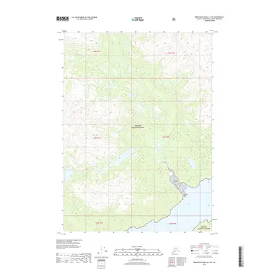
2017 Map of Bradfield Canal A-4 SW
USGS Topo · Published 2017About this map
The Tongass National Forest dominates this coastal landscape in the Ketchikan Gateway region of southeast Alaska. The terrain is defined by the steep drainage of Grant Cr, which winds through the central and northern sections of the map toward the shoreline. This 2017 survey reflects the remote, federally managed character of the area, where the vast majority of the land is designated as Tnf property. The map provides a look at the intricate contour patterns of the Alaskan Panhandle, illustrating the relationship between the high alpine elevations and the creek beds that feed into the canal. Aside from the forest designations and the primary waterway, the area remains largely undeveloped, preserving a wilderness state that is typical of this portion of the Alexander Archipelago.
Find a feature on this map
9 named features on this map. Tap any name to fly to it.
Don’t see what you’re looking for? This feature index may not catch every label — zoom into the map to look around manually.
Map Details
Editions of this 2017 Bradfield Canal A-4 SW Map
This is the sole edition of this map. No revisions or reprints were ever made.
Other maps of this area

1951 · Bradfield Canal
USGS Topo · 1:250,000

1952 · Ketchikan
USGS Topo · 1:250,000

1952 · Ketchikan D-5
USGS Topo · 1:63,360

1953 · Ketchikan D-5
USGS Topo · 1:63,360

1954 · Bradfield Canal
USGS Topo · 1:250,000

1955 · Bradfield canal A-4
USGS Topo · 1:63,360

1955 · Ketchikan D-4
USGS Topo · 1:63,360

1955 · Bradfield Canal A-5
USGS Topo · 1:63,360

1955 · Ketchikan
USGS Topo · 1:250,000

1955 · Bradfield Canal
USGS Topo · 1:250,000