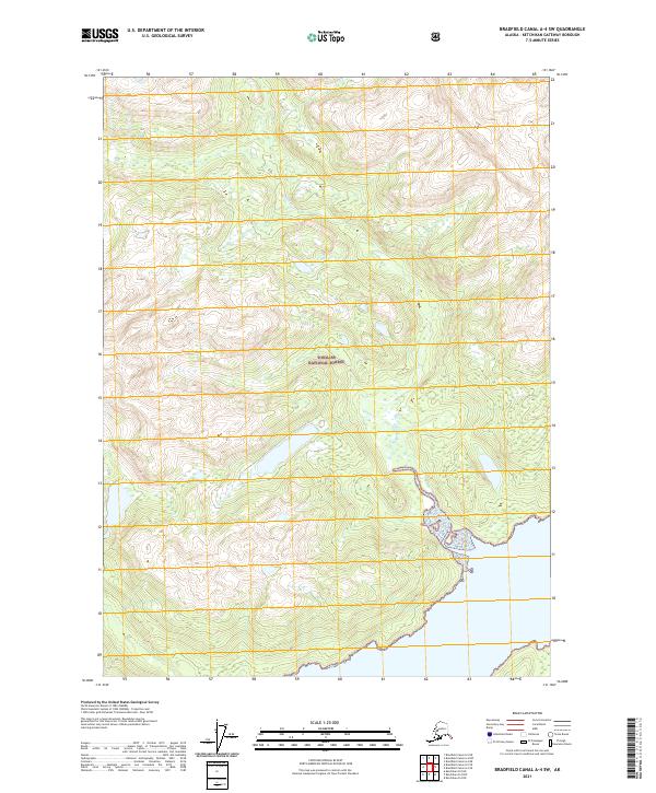
2021 Map of Bradfield Canal A-4 SW
USGS Topo · Published 2021About this map
Tongass National Forest dominates this coastal Alaska landscape, where the steep terrain of the Southeast panhandle meets the tidewaters of the Bradfield Canal. The map illustrates a complex network of glacial valleys and mountain ridges, defined largely by the drainage of Grant Cr as it flows toward the saltwater shoreline. This 2021 survey provides a contemporary view of the forest boundaries and township lines, including t67s r91e and t68s r92e, which are essential for understanding land management and surveying history in this wilderness region. The interaction between the high-elevation contours and the intricate coastline reflects the dramatic geography of the Alexander Archipelago, showing the exact points where freshwater streams reach the sea.
Find a feature on this map
8 named features on this map. Tap any name to fly to it.
Don’t see what you’re looking for? This feature index may not catch every label — zoom into the map to look around manually.
Map Details
Editions of this 2021 Bradfield Canal A-4 SW Map
This is the sole edition of this map. No revisions or reprints were ever made.
Other maps of this area

1951 · Bradfield Canal
USGS Topo · 1:250,000

1952 · Ketchikan
USGS Topo · 1:250,000

1952 · Ketchikan D-5
USGS Topo · 1:63,360

1953 · Ketchikan D-5
USGS Topo · 1:63,360

1954 · Bradfield Canal
USGS Topo · 1:250,000

1955 · Bradfield canal A-4
USGS Topo · 1:63,360

1955 · Ketchikan D-4
USGS Topo · 1:63,360

1955 · Bradfield Canal A-5
USGS Topo · 1:63,360

1955 · Ketchikan
USGS Topo · 1:250,000

1955 · Bradfield Canal
USGS Topo · 1:250,000