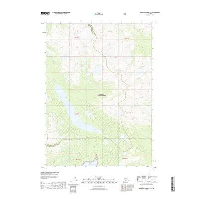
2017 Map of Bradfield Canal A-5 SE
USGS Topo · Published 2017About this map
Tongass National Forest dominates this coastal Alaskan landscape, where the steep topography of the Alexander Archipelago meets the tidal waters of Bell Arm. The area is defined by its dramatic glacial carved valleys and significant freshwater systems, most notably Eagle Lake, which feeds into the Eagle River before reaching the coast. This map illustrates the administrative boundary between Wrangell Borough and Ketchikan Gateway Borough, a line that traverses some of the most isolated terrain in the region. Apart from the small drainage of Grant Creek in the northeast, the land remains largely undeveloped, preserving a wilderness character that reflects the natural state of Southeast Alaska in the early 21st century.
Find a feature on this map
13 named features on this map. Tap any name to fly to it.
Don’t see what you’re looking for? This feature index may not catch every label — zoom into the map to look around manually.
Map Details
Editions of this 2017 Bradfield Canal A-5 SE Map
This is the sole edition of this map. No revisions or reprints were ever made.
Other maps of this area

1951 · Bradfield Canal
USGS Topo · 1:250,000

1952 · Ketchikan
USGS Topo · 1:250,000

1952 · Ketchikan D-5
USGS Topo · 1:63,360

1953 · Ketchikan D-5
USGS Topo · 1:63,360

1954 · Bradfield Canal
USGS Topo · 1:250,000

1955 · Bradfield canal A-4
USGS Topo · 1:63,360

1955 · Ketchikan D-4
USGS Topo · 1:63,360

1955 · Bradfield Canal A-5
USGS Topo · 1:63,360

1955 · Ketchikan
USGS Topo · 1:250,000

1955 · Bradfield Canal
USGS Topo · 1:250,000