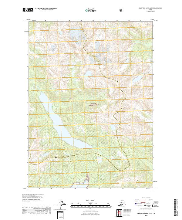
2021 Map of Bradfield Canal A-5 SE
USGS Topo · Published 2021About this map
Tongass National Forest dominates this Alaskan landscape, characterized by the dramatic interaction of coastal waters and steep elevations. The Eagle River feeds into the expansive Eagle Lake, which serves as a central hydrological feature in the western portion of the quadrangle. To the south, the tidal waters of Bell Arm indicate the transition toward the coastal fjords of the region. A notable administrative detail is the boundary between the Ketchikan Gateway Borough and Wrangell City and Borough, which winds through the mountainous terrain. This 2021 survey reveals a landscape largely devoid of modern development, where the drainages of Grant Cr and other unnamed tributaries carve through the Tongass wilderness.
Find a feature on this map
13 named features on this map. Tap any name to fly to it.
Don’t see what you’re looking for? This feature index may not catch every label — zoom into the map to look around manually.
Map Details
Editions of this 2021 Bradfield Canal A-5 SE Map
This is the sole edition of this map. No revisions or reprints were ever made.
Other maps of this area

1951 · Bradfield Canal
USGS Topo · 1:250,000

1952 · Ketchikan
USGS Topo · 1:250,000

1952 · Ketchikan D-5
USGS Topo · 1:63,360

1953 · Ketchikan D-5
USGS Topo · 1:63,360

1954 · Bradfield Canal
USGS Topo · 1:250,000

1955 · Bradfield canal A-4
USGS Topo · 1:63,360

1955 · Ketchikan D-4
USGS Topo · 1:63,360

1955 · Bradfield Canal A-5
USGS Topo · 1:63,360

1955 · Ketchikan
USGS Topo · 1:250,000

1955 · Bradfield Canal
USGS Topo · 1:250,000