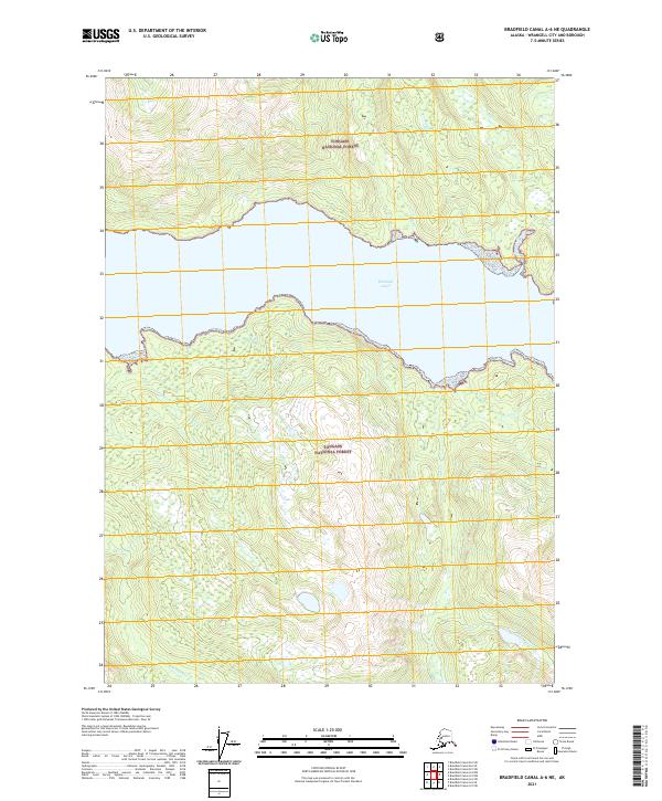
2021 Map of Bradfield Canal A-6 NE
USGS Topo · Published 2021About this map
Bradfield Canal serves as the central waterway of this coastal Alaskan landscape, carving through the dense, protected wilderness of the Tongass National Forest. The map documents a rugged maritime environment where several drainages, including Tom Cr, Shag Cr, and Hoya Cr, descend from steep elevations into the tidal waters of the canal. The absence of roads or established settlements emphasizes the remote nature of this region within the Wrangell City and Borough. Instead, the geography is defined by its complex hydrography, featuring the Grau Cr and the E Fork Anan Cr to the south. This 2021 survey illustrates the contemporary boundaries and topographical contours of a territory governed by its waterway access and forest management, providing a clear record of the shoreline and drainage patterns as they existed in the early twenty-first century.
Find a feature on this map
11 named features on this map. Tap any name to fly to it.
Don’t see what you’re looking for? This feature index may not catch every label — zoom into the map to look around manually.
Map Details
Editions of this 2021 Bradfield Canal A-6 NE Map
This is the sole edition of this map. No revisions or reprints were ever made.
Other maps of this area

1951 · Bradfield Canal
USGS Topo · 1:250,000

1954 · Bradfield Canal
USGS Topo · 1:250,000

1955 · Bradfield canal A-6
USGS Topo · 1:63,360

1955 · Bradfield canal B-5
USGS Topo · 1:63,360

1955 · Bradfield Canal A-5
USGS Topo · 1:63,360

1955 · Bradfield canal B-6
USGS Topo · 1:63,360

1955 · Bradfield Canal
USGS Topo · 1:250,000
2000 · Bradfield Canal B-6
USGS Topo · 1:63,360
2000 · Bradfield Canal A-6
USGS Topo · 1:63,360
2017 · Bradfield Canal B-5 SW
USGS Topo · 1:25,000