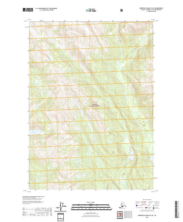
2021 Map of Bradfield Canal B-6 SE
USGS Topo · Published 2021About this map
Tongass National Forest encloses this glacially carved landscape in Wrangell City and Borough, dominated by the winding course of the Harding River. The terrain is defined by extreme verticality, where high-altitude drainages like Orms Cr and Tom Cr feed into a network of alpine lakes. These water bodies, including Upper Marien Lake in the west and Campbell Lake and Tom Lake in the southeast, are situated within deep basins that reflect the characteristic topography of the Alaska Panhandle. The absence of roads or permanent settlements highlights the wilderness character of the region, where the primary structural features are the survey lines of townships such as t64s r88e and t65s r89e. This 2021 update provides a precise look at the modern drainage patterns and forest boundaries in an area defined by its difficult access and dramatic elevation changes.
Find a feature on this map
13 named features on this map. Tap any name to fly to it.
Don’t see what you’re looking for? This feature index may not catch every label — zoom into the map to look around manually.
Map Details
Editions of this 2021 Bradfield Canal B-6 SE Map
This is the sole edition of this map. No revisions or reprints were ever made.
Other maps of this area

1951 · Bradfield Canal
USGS Topo · 1:250,000

1954 · Bradfield Canal
USGS Topo · 1:250,000

1955 · Bradfield canal A-6
USGS Topo · 1:63,360

1955 · Bradfield canal B-5
USGS Topo · 1:63,360

1955 · Bradfield Canal A-5
USGS Topo · 1:63,360

1955 · Bradfield canal B-6
USGS Topo · 1:63,360

1955 · Bradfield Canal
USGS Topo · 1:250,000
2000 · Bradfield Canal B-6
USGS Topo · 1:63,360
2000 · Bradfield Canal A-6
USGS Topo · 1:63,360
2017 · Bradfield Canal B-5 SW
USGS Topo · 1:25,000