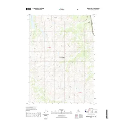
2017 Map of Bradfield Canal C-6 SW
USGS Topo · Published 2017About this map
The international boundary between Canada and the United States of America runs along the eastern edge of this terrain, marking the divide between British Columbia and the Wrangell City and Borough of Alaska. This high-altitude landscape is dominated by the Coast Mountains, where peaks like Mt Flemer and Mt Cote rise above a complex network of glacial drainage systems. Within the protected bounds of the Tongass National Forest, the Kikahe River winds through deep valleys, joined by smaller tributaries including Goat Creek and Nelson Cr. The absence of roads or permanent settlements underscores the wilderness character of this border region, where the primary features are the relief of the peaks and the natural flow of the watercourses in a remote section of the Pacific Northwest.
Find a feature on this map
16 named features on this map. Tap any name to fly to it.
Don’t see what you’re looking for? This feature index may not catch every label — zoom into the map to look around manually.
Map Details
Editions of this 2017 Bradfield Canal C-6 SW Map
This is the sole edition of this map. No revisions or reprints were ever made.
Other maps of this area

1948 · Petersburg C-1
USGS Topo · 1:63,360

1948 · Petersburg B-1
USGS Topo · 1:63,360

1951 · Bradfield Canal
USGS Topo · 1:250,000

1952 · Petersburg
USGS Topo · 1:250,000

1953 · Petersburg C-1
USGS Topo · 1:63,360

1954 · Bradfield Canal
USGS Topo · 1:250,000

1955 · Bradfield canal C-6
USGS Topo · 1:63,360

1955 · Bradfield canal B-6
USGS Topo · 1:63,360

1955 · Petersburg B-1
USGS Topo · 1:63,360

1955 · Bradfield Canal
USGS Topo · 1:250,000