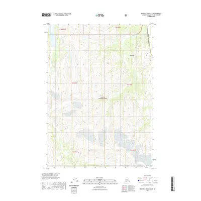
2021 Map of Bradfield Canal C-6 SW
USGS Topo · Published 2021About this map
The international boundary between the United States and Canada defines the eastern edge of this high-elevation coastal landscape, where the peaks of Mt Flemer and Mt Cote loom over the wilderness. This 2021 survey of the Tongass National Forest showcases a complex system of glaciers and high-altitude drainage basins that feed into the Kikahe River and Aaron Cr. The terrain is characterized by massive ice fields and steep contours typical of the Wrangell region. Without roads or permanent settlements, the map focuses on natural water systems like Goat Creek and the intricate movement of the glacial line, providing a precise record of the regional cryosphere and its shifting boundaries at the start of the 2020s.
Find a feature on this map
10 named features on this map. Tap any name to fly to it.
Don’t see what you’re looking for? This feature index may not catch every label — zoom into the map to look around manually.
Map Details
Editions of this 2021 Bradfield Canal C-6 SW Map
This is the sole edition of this map. No revisions or reprints were ever made.
Other maps of this area

1948 · Petersburg C-1
USGS Topo · 1:63,360

1948 · Petersburg B-1
USGS Topo · 1:63,360

1951 · Bradfield Canal
USGS Topo · 1:250,000

1952 · Petersburg
USGS Topo · 1:250,000

1953 · Petersburg C-1
USGS Topo · 1:63,360

1954 · Bradfield Canal
USGS Topo · 1:250,000

1955 · Bradfield canal C-6
USGS Topo · 1:63,360

1955 · Bradfield canal B-6
USGS Topo · 1:63,360

1955 · Petersburg B-1
USGS Topo · 1:63,360

1955 · Bradfield Canal
USGS Topo · 1:250,000