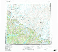
1955 Map of Bradfield Canal
USGS Topo · Published 1970About this map
The Coast Mountains dominate this 1955 survey of the international boundary between Alaska and British Columbia. This landscape is defined by massive ice fields and drainage systems, where the Stikine River and Unuk River carve deep valleys through the Tongass National Forest toward the Pacific. The intricate coastline features the Bradfield Canal and Ernest Sound, providing essential maritime access to this otherwise inaccessible terrain.
Find a feature on this map
140 named features on this map. Tap any name to fly to it.
Don’t see what you’re looking for? This feature index may not catch every label — zoom into the map to look around manually.
Map Details
Editions of this 1955 Bradfield Canal Map
2 editions found

Other maps of this area

1948 · Petersburg A-1
USGS Topo · 1:63,360

1948 · Petersburg C-1
USGS Topo · 1:63,360

1948 · Petersburg B-1
USGS Topo · 1:63,360

1949 · Craig D-1
USGS Topo · 1:63,360

1951 · Bradfield Canal
USGS Topo · 1:250,000

1951 · Craig D-1
USGS Topo · 1:63,360

1951 · Petersburg A-1
USGS Topo · 1:63,360

1952 · Petersburg
USGS Topo · 1:250,000

1952 · Ketchikan
USGS Topo · 1:250,000

1952 · Sumdum
USGS Topo · 1:250,000