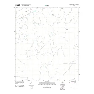
2010 Map of Bradford Creek
USGS Topo · Published 2010About this map
The South Llano River carves through this portion of Edwards County, defining a landscape shaped by intermittent waterways and essential ranching infrastructure. This 2010 survey highlights the importance of water management in this arid region, where family-named and functional landmarks like the Shearing Barn Windmill, Double Tank Windmill, and Double Round Tank Windmill mark the positions of critical resources. Along the river, distinctive features such as Blue Hole on the Llano, Dripping Springs, and McKee Spring indicate where groundwater reaches the surface, providing points of interest for local history and environmental study.
Find a feature on this map
14 named features on this map. Tap any name to fly to it.
Don’t see what you’re looking for? This feature index may not catch every label — zoom into the map to look around manually.
Map Details
Editions of this 2010 Bradford Creek Map
This is the sole edition of this map. No revisions or reprints were ever made.
Other maps of this area

1893 · Rock Springs
USGS Topo · 1:125,000

1926 · Segovia 2-c
USGS Topo · 1:48,000

1932 · Junction
USGS Topo · 1:62,500

1954 · Llano
USGS Topo · 1:250,000

1954 · Sonora
USGS Topo · 1:250,000

1955 · Llano
USGS Topo · 1:250,000

1956 · Llano
USGS Topo · 1:250,000

1958 · Sonora
USGS Topo · 1:250,000

1962 · Hill Ranch
USGS Topo · 1:24,000
1971 · Paint Rock Spring
USGS Topo · 1:24,000