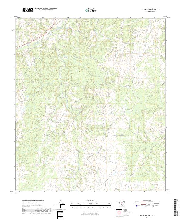
2022 Map of Bradford Creek
USGS Topo · Published 2022About this map
The S Llano River carves through the Edwards County landscape in the northwestern portion of this quadrangle, creating a distinct riparian corridor amidst the limestone plateau. This reach of the river is marked by significant hydrological features, including the Blue Hole on the Llano and the nearby Dripping Springs. The terrain is defined by a complex network of ephemeral drainages and creeks, such as Contrary Cr, W Prong Contrary Cr, and Bradford Cr, which have eroded deep canyons and draws into the surrounding highlands. Isolated water sources like Mc Kee Spring provide critical points of interest in an otherwise arid environment. This 2022 survey illustrates the sparse human footprint in the region, with ranch roads such as Co Rd 408 and Hackberry Rd providing the primary access to the remote interior lands of the Hill Country.
Find a feature on this map
14 named features on this map. Tap any name to fly to it.
Don’t see what you’re looking for? This feature index may not catch every label — zoom into the map to look around manually.
Map Details
Editions of this 2022 Bradford Creek Map
This is the sole edition of this map. No revisions or reprints were ever made.
Other maps of this area

1893 · Rock Springs
USGS Topo · 1:125,000

1926 · Segovia 2-c
USGS Topo · 1:48,000

1932 · Junction
USGS Topo · 1:62,500

1954 · Llano
USGS Topo · 1:250,000

1954 · Sonora
USGS Topo · 1:250,000

1955 · Llano
USGS Topo · 1:250,000

1956 · Llano
USGS Topo · 1:250,000

1958 · Sonora
USGS Topo · 1:250,000

1962 · Hill Ranch
USGS Topo · 1:24,000
1971 · Paint Rock Spring
USGS Topo · 1:24,000