
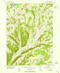
1953 Map of Bradford
USGS Topo · Published 1955About this map
Bradford and Monterey anchor this mid-century portrait of the borderlands between Schuyler and Steuben Counties. The landscape is defined by the narrow valleys of Pine Creek, Meads Creek, and Mud Creek, where small farm clusters and district schools once served a rural population. The survey records a high density of small family and community burial grounds, including the Old Sugar Hill Cem, Maltby Cem, and Christ Johns Cem, which offer significant value for genealogists tracing early residents of the Orange and Bradford townships. The upland terrain remains largely forested, punctuated by isolated landmarks like Old Sugar Hill and the waters of Cinnamon Lake. Evidence of the area's educational history is preserved through labels for the Star District Sch and several District No 1 locations, reflecting the traditional decentralized school system before widespread consolidation in the Southern Tier.
Find a feature on this map
27 named features on this map. Tap any name to fly to it.
Don’t see what you’re looking for? This feature index may not catch every label — zoom into the map to look around manually.
Map Details
Editions of this 1953 Bradford Map
Other maps of this area

1895 · Elmira
USGS Topo · 1:62,500

1898 · Watkins Glen
USGS Topo · 1:62,500

1901 · Watkins
USGS Topo · 1:62,500

1903 · Hammondsport
USGS Topo · 1:62,500

1905 · Watkins Glen
USGS Topo · 1:125,000

1914 · Corning
USGS Topo · 1:62,500

1944 · Corning
USGS Topo · 1:62,500

1950 · Elmira
USGS Topo · 1:250,000
1950 · Reading Center
USGS Topo · 1:24,000
1953 · Wayne
USGS Topo · 1:24,000