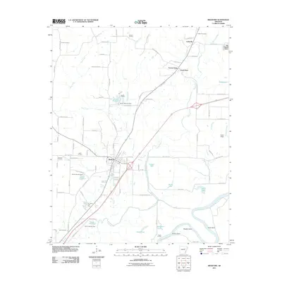
2011 Map of Bradford
USGS Topo · Published 2011About this map
Bradford serves as the central hub of this northeastern Arkansas landscape, where the Union Pacific railroad corridor dictates the alignment of local commerce and travel. The map captures the intricate water systems of the region, defined by the winding White River and its associated backwaters like Goose Pond, Beaver Lake, and the evocative Dudley Dread. Small settlements such as Possum Grape, Grand Glaise, and Coffeeville are dispersed along the road networks, connected by numerous family-named routes and Jackson County roads.
Find a feature on this map
102 named features on this map. Tap any name to fly to it.
Don’t see what you’re looking for? This feature index may not catch every label — zoom into the map to look around manually.
Map Details
Editions of this 2011 Bradford Map
This is the sole edition of this map. No revisions or reprints were ever made.
Other maps of this area

1890 · Batesville
USGS Topo · 1:125,000

1891 · Batesville
USGS Topo · 1:125,000

1935 · Newport
USGS Topo · 1:62,500

1935 · Augusta
USGS Topo · 1:62,500

1935 · Bald Knob
USGS Topo · 1:62,500

1953 · Memphis
USGS Topo · 1:250,000

1956 · Memphis
USGS Topo · 1:250,000

1957 · Augusta
USGS Topo · 1:62,500
1962 · Olyphant
USGS Topo · 1:24,000

1962 · Newport
USGS Topo · 1:24,000