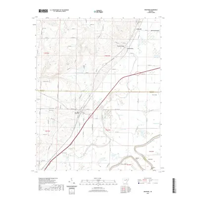
2020 Map of Bradford
USGS Topo · Published 2020About this map
The town of Bradford anchors this landscape in White County, where the transition from higher ground toward the bottomlands of the White River is clearly defined. The terrain is crisscrossed by an intricate drainage system including Piney Cr, Oats Cr, and Departee Creek, which feed into numerous wetlands and sloughs such as Bear Water Slough and Goose Pond. Several small settlements and rural communities are documented, including Possum Grape, Grand Glaise, and Old Grand Glaise, reflecting the historical settlement patterns along the river corridor.
Find a feature on this map
95 named features on this map. Tap any name to fly to it.
Don’t see what you’re looking for? This feature index may not catch every label — zoom into the map to look around manually.
Map Details
Editions of this 2020 Bradford Map
This is the sole edition of this map. No revisions or reprints were ever made.
Other maps of this area

1890 · Batesville
USGS Topo · 1:125,000

1891 · Batesville
USGS Topo · 1:125,000

1935 · Newport
USGS Topo · 1:62,500

1935 · Augusta
USGS Topo · 1:62,500

1935 · Bald Knob
USGS Topo · 1:62,500

1953 · Memphis
USGS Topo · 1:250,000

1956 · Memphis
USGS Topo · 1:250,000

1957 · Augusta
USGS Topo · 1:62,500
1962 · Olyphant
USGS Topo · 1:24,000

1962 · Newport
USGS Topo · 1:24,000