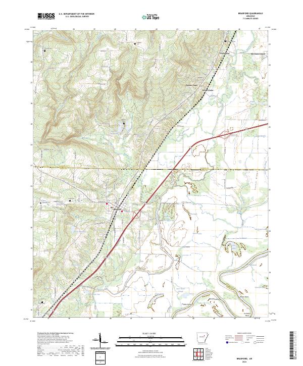
2024 Map of Bradford
USGS Topo · Published 2024About this map
Bradford serves as a central hub in this modern survey of the White and Jackson county border, where the landscape transitions from the upland drainage of Oats Creek and Piney Creek into the alluvial bottomlands of the White River. The settlement pattern reflects the area's river-driven history, anchored by the town of Grand Glaise and the nearby site of Old Grand Glaise. To the north, small communities like Coffeeville and the evocatively named Possum Grape sit among a network of rural routes such as Jackson 306 and Jackson 365.
Find a feature on this map
90 named features on this map. Tap any name to fly to it.
Don’t see what you’re looking for? This feature index may not catch every label — zoom into the map to look around manually.
Map Details
Editions of this 2024 Bradford Map
This is the sole edition of this map. No revisions or reprints were ever made.
Other maps of this area

1890 · Batesville
USGS Topo · 1:125,000

1891 · Batesville
USGS Topo · 1:125,000

1935 · Newport
USGS Topo · 1:62,500

1935 · Augusta
USGS Topo · 1:62,500

1935 · Bald Knob
USGS Topo · 1:62,500

1953 · Memphis
USGS Topo · 1:250,000

1956 · Memphis
USGS Topo · 1:250,000

1957 · Augusta
USGS Topo · 1:62,500
1962 · Olyphant
USGS Topo · 1:24,000

1962 · Newport
USGS Topo · 1:24,000